In Port Arthur, another EF-2 tornado with a width of around 300 yards traveled more than 2 miles, damaging homes and ripping down trees, according to the weather service.
“It was pretty bad,” Michelle Viator, of Lake Charles, told NBC affiliate KPLC. “I mean, everything’s down.”
Viator’s home was damaged, but a family down her street who have two children had been trapped by the damage to their home, Viator told the station in Lake Charles.
On Tuesday, heavy rain, hail and high winds hits Mississippi and other Southern states.
Mississippi Gov. Tate Reeves announced Wednesday that there had been one weather-related death in his state, in Scott County, and a person injured in Grenada County.
“Please pray for them and their families during this difficult time,” Reeves said on X.
He said preliminary information was that 72 homes were damaged or destroyed in Grenada, Hinds, Marshall, Scott, Warren and Yazoo County.
More than 4 inches of rain fell in Mississippi’s Hinds County, and more than 5 inches in Holmes, Rankin and Sharkey counties, the weather service in Jackson said.
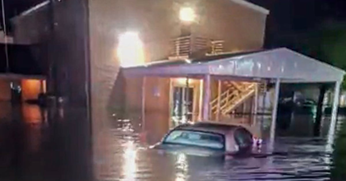
In New Orleans, streets flooded Wednesday. A flash flood emergency had been declared for the metro area, and the weather service there warned residents “DO NOT DRIVE right now!” New Orleans police showed images of inundated roads and urged people to avoid flooded areas.
St. Tammany Parish, on the north shore of Lake Pontchartrain across from New Orleans, shared footage of destruction including downed trees, and destroyed houses and buildings amid heavy rain.
The National Weather Service said it found damage consistent with an EF-1 tornado in Slidell near Old Spanish Trail, but said more storm surveys would need to be done to determine the path, length and wind speeds.
An EF-1 tornado also struck the Houston suburb of Katy early Wednesday with 90 mph maximum winds, officials said. While the damage survey is still ongoing, it’s consistent with an EF-1 tornado, Jeff Evans of the National Weather Service Office in Houston/Galveston told reporters.
Wednesday’s severe weather comes after there were more than 90 storm reports Tuesday, including reports of hail as large as 4.25 inches in diameter across Texas.
Jasper, Texas, marked 7.58 inches of rainfall; 7.38 inches were clocked in Marshall, Texas; 7.22 inches at Big Sunflower River in Holly Bluff, Mississippi; and 6.24 inches in Monroe, Louisiana. In Kirbyville, Texas, the Pin Oak Creek rose 10 feet in less than six hours.
A disaster declaration was issued for Jasper County, Texas, which covers Kirbyville, on Wednesday. The Jasper County Sheriff’s Office said the city “remains under water” Wednesday morning and rescue teams have extricated “several” people out of vehicles and homes.
By Wednesday evening, high wind advisories covered much of the South. In Birmingham, Alabama, forecasters said there could be 45 mph wind gusts and the advisory there lasted until 7 a.m. Thursday.
Tornado watches covered an area of the Florida Panhandle and southwestern Georgia at 6:45 p.m. ET.
Around 136,000 customers across Louisiana remained without power Wednesday evening, according to tracking website poweroutage.us.
Severe risk continues Thursday for the Ohio Valley, the Southeast and northern Florida. Thursday’s risks are lower than Wednesday’s, but all hazards will be possible for cities including Jacksonville, Tallahassee and Tampa, Florida, for the southern risk area and Columbus and Cleveland, Ohio, and Pittsburgh, Pennsylvania, across the northern risk area.
